
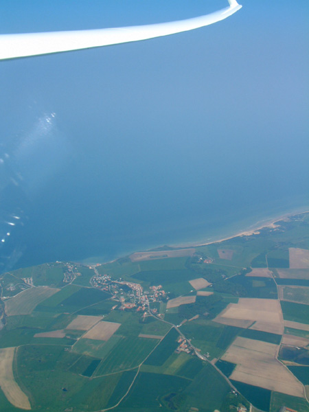
We had been following the weather for several days prior to the start of our expedition and there seemed to be a chance of a flight into Europe, starting from the UK.
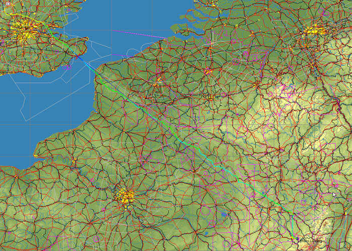
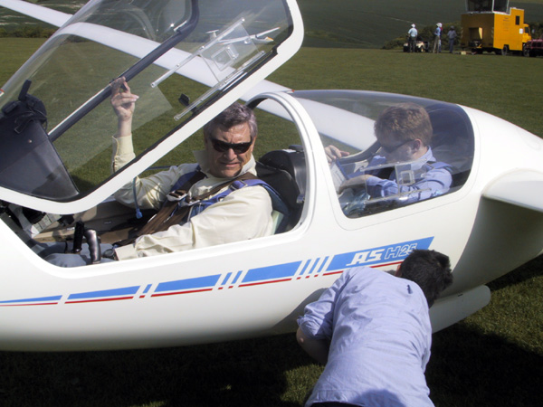
We began the tow just before 10am and obtained a clearance from Luton to go through their airspace. We were about to fly overhead the airport when there was a quiet click from below and we watched in disbelief as the towrope floated away. Luckily, we were still just in range of the Club and were able to sneak over the Downs and land back at the aerotow point. We launched again at 1030, having disabled the back release...
The next hour and a bit was one of the most unpleasant times I have ever spent in a glider. The visibility was poor, we were flying into-sun, it was turbulent with broken thermals under a low inversion and it was three-quarters of an hour before we could climb above 2500'ASL due to the LTMA. At least there were two of us in the ASH: Pete Claiden, solo in the tug, was taking the brunt of the pulling around and navigation.
Thanks Pete for working so hard at the tug end.
During the next hour we averaged 2-3Kts with the cloudbase slowly rising to 4800'ASL as we approached Arras. There was a north-easterly wind but it was light enough not to be significant. We passed Cambrai at 5000' and then fell into a bit of a hole to the east of St. Quentin. As was repeated throughout the day, the clouds looked OK but the thermals were weak and difficult to locate.
We eventually climbed up again north of Laon, at which point the visibility improved greatly and we could see cumulus for at least 75Km in the direction we wanted to go. Again, it wasn't as good as it looked but we were able to add another 100Km in the next hour, with the cloudbase rising to 5500'.

Approaching Nancy at just after 6pm, the few remaining cumulus started to grow vertically and we caught sight of some cu-nim anvils to the east. After a climb just short of the town, we were on a glide for Luneville, 35Km to the SE.
Running towards the airfield we came up against a line of storms oriented N-S. We climbed on the edge of the rain and examined our options. We decided not to go any further east as the cloudbase wasn't high enough for a safe crossing of the Vosges. The whole area was congested with cu-nims and the 'bolt-hole' airfield at St. Die (really) looked marginally sized for the ASH.
We ran South along a line of black cloud and lost no height for 20Kms, putting us well over for the airfield at Epinal. After arriving at the town we pushed out to the east with our remaining altitude but there was no real soaring opportunity and the outlanding options were becoming very limited, so we landed at Epinal Dogneville at half past seven.